Drone and UAV Services
Drone and UAV Services
access and inspect the inaccessible, impractical and impossible
access and inspect the inaccessible, impractical and impossible
Puffin operates the very latest Elios 2 from Flyability as well as a number of DJI systems including the Matrice M300 RTK and Zenmuse P1 and H20T cameras. Coupled with our 10 years TICC market knowledge and Civil Aviation Authority (CAA) specific category permission to operate our unmanned systems to within 10m of non involved persons, Puffin has the tools and experience


Thermography
Drone payloads can include thermographic cameras. The non-invasive nature of drone enables faster and safer identification of potential issues, allowing the maintenance crews to focus on what matters. Typical applications include search and rescue, thermal bridging identification, drainage issues and crop yield studies
The example shows an overlay of thermal leakage and the performance of the thermal barrier within the ducting
Photogrammetry
Photogrammetry software builds 3D models from 2D photographs. Typical applications include mapping, structures, stockpile measurement and digital surface models
Structures can be quickly built from imagery acquired by drone. These 3D models can be used to inform maintenance repair and budget decisions. As the models are spatially correct - accurate measurements and defect location can be made
Models can be imported into BIM and CAD software
Inspection
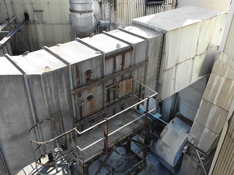
Drones compliment the work of engineering teams by removing restrictions on access and ensuring safety in the tightest, most awkward of spaces. This reduces risk and often eliminates the need for expensive access equipment
The photograph shows the corrosion of ducting located at height. Access constraints meant only viable solution was scaffolding. By deploying a drone the client was able to assess the roof structure safely and for a fraction of the cost and time
Drone assisted inspection enables cost effective, safe and timely monitoring of your assets
Orthomosaic
Using a series of stitched photographs which are geometrically corrected, large yet detailed, views can be built. Unlike an uncorrected aerial photograph, orthographs can be used to obtain accurate measurements or confirm construction is in the correct position. Similar to Google Earth, orthography is an accurate background to maps
This example is an quarry showing levels of detail - it is one single orthograph. The largest area covers 11 hectares
